Come on, the Lions are AMAZING! Coincidentally, off that same trail head, is another amazing hike that sees relatively little traffic. That is the hike to the summit of Mt. Harvey. Mount who? What? Who is this Harvey fellow? Why wouldn’t anyone name a mountain after him?
Well, apparently Wikipedia actually has the answer to that question - and to a level of detail that surprised us.
“the mountain was named in association with the marine battle of 1794 known as the Glorious First of June. Such names were conferred by Captain Richards of HMS Plumper during his survey of the region in 1859. John Harvey (1740–1794) was the captain of HMS Brunswick and lost a limb in that battle, dying from complications from it soon afterwards.”
Anyway, we aren’t here to talk about the history of a mountain. We are here to tell you about the amazing view you will get when you are standing far above the world - and how much your legs will hate you the day after. And maybe even the day after that.
*Disclaimer - we did this hike in the middle of June, after having quite a bit of hot, dry weather, so there was almost no snow at the top of the hike. We do not advise doing this hike in the winter, as there have been some fatalities from a collapsing cornice.*
Trail Map & Photo Stops
The Journey to the Top
Seeing as the trail head to Mount Harvey is the same one you use for hiking up to the Lions, you can park at the same parking lot. Be warned that the parking lot is small and costs money. The lot holds about a total of 10 cars and costs 2 dollars per hour - maxing out at 16 dollars for the day. Plan to arrive early if you want a spot, otherwise you are left to park a bit further away on a residential street. Be mindful not to park in front of anyone’s house or driveway!
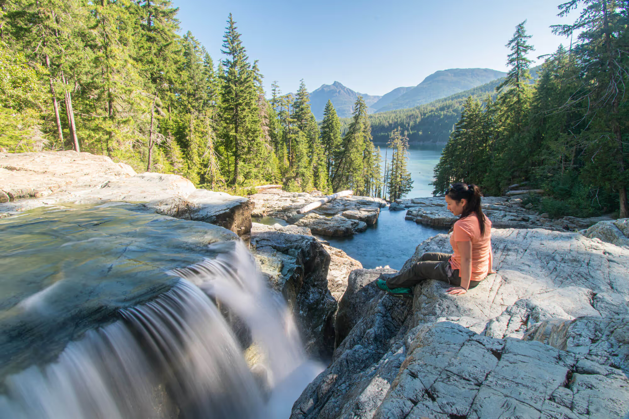
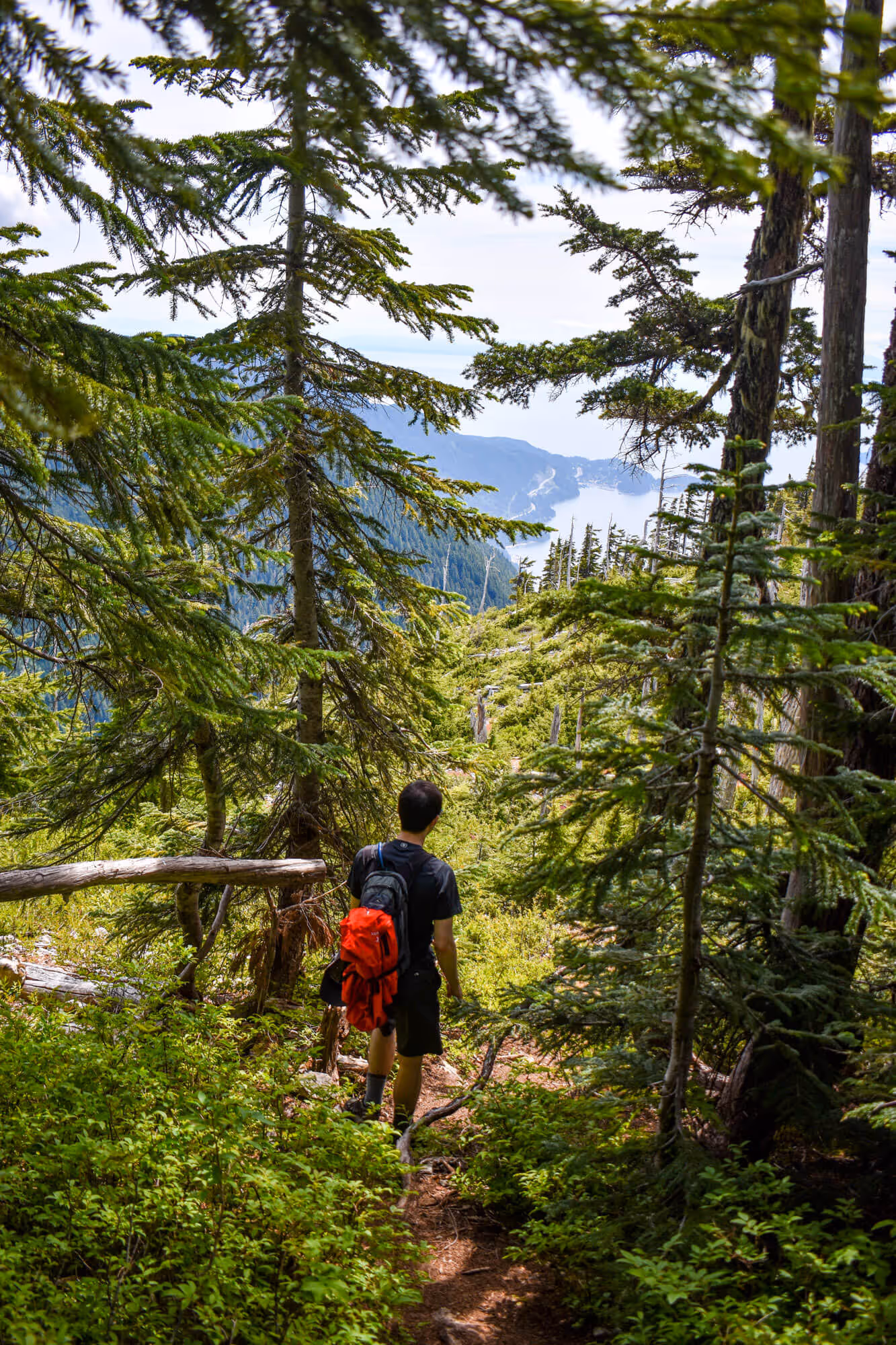
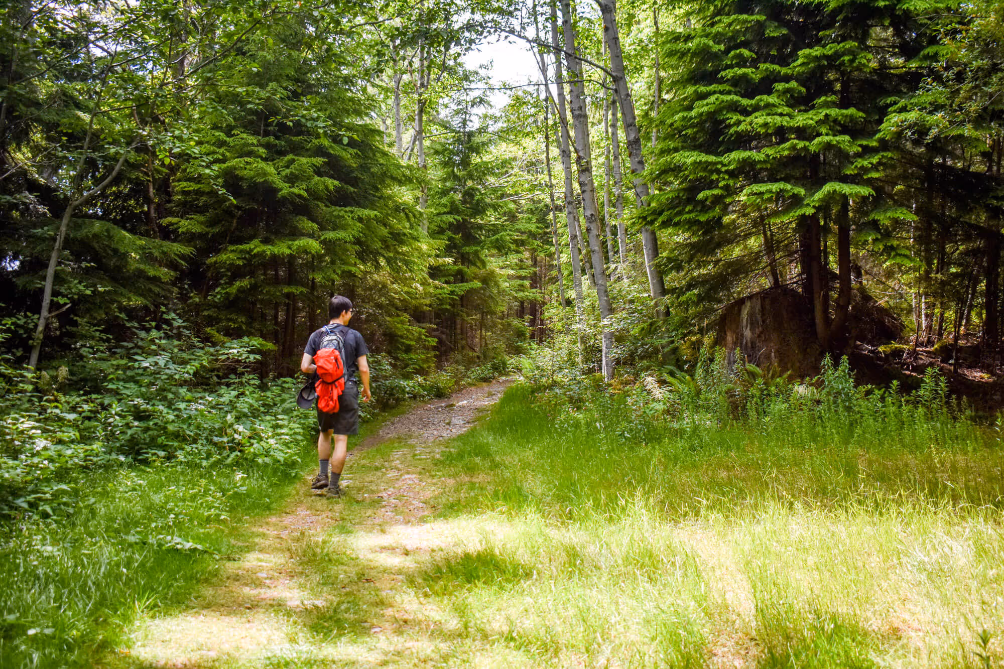
The first half of the trail is the exact same as the trail heading to the Lions. In fact, you will see signs telling you how to get to Brunswick, Harvey and the Lions. These signs are pretty obvious, so we just followed them. HOWEVER, we did get a little caught up looking at our feet while hiking and made a bit of a mistake. We missed the turnoff to Harvey. IF YOU REACH THE WATERFALL AND HAVE TO CROSS A RUINED BRIDGE, YOU HAVE GONE TOO FAR. I mean...the waterfall is pretty nice to look at, and if you drink lots of water, you can always refill here (be safe and filter/tablet your water).


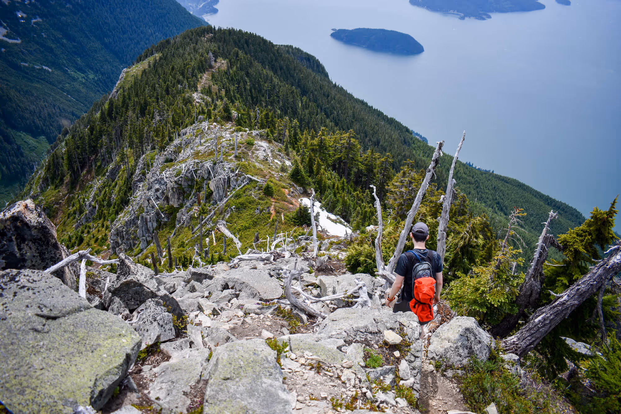
Once you make the proper turnoff to head up Harvey, you will realize that you just doing the Grouse Grind, but with no stairs. The rest of the hike is pretty much vertical. ALL THAT ELEVATION GAIN. There are a couple of decent viewpoints on the way up, which act as a good place to sit down, drink some water, stuff food into your face, and catch a break.
The trail to Mt. Harvey has a considerable amount of wildlife on the trail. Countless times on the trail, you would hear the bush beside you rustle, and a chipmunk would be darting up a tree, or the low rumblings of a grouse. In fact...Chris got in a bit of a standoff with a grouse that was blocking the trail to protect its young. Make yourself look big and intimidating, right? That is how you are supposed to scare away ALL animals...right?


If you like scotch… this hike also has a pretty cool geocache sitting near the top. We actually found it by accident. For those of you who don’t know what geocaching is, it is like a global treasure hunt that uses GPS coordinates. (Checking online now, the cache isn’t actually on geocaching.com - the site we normally use). This was probably the highlight of the trip for Chris.

Conclusion
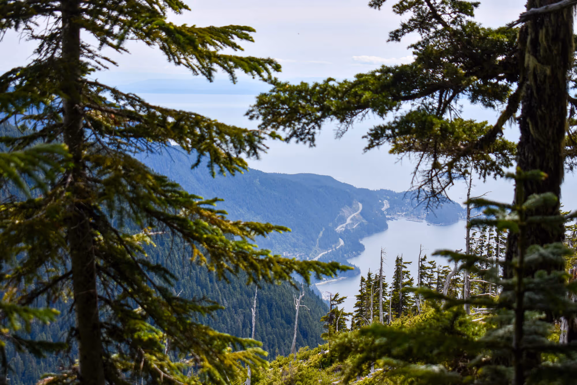
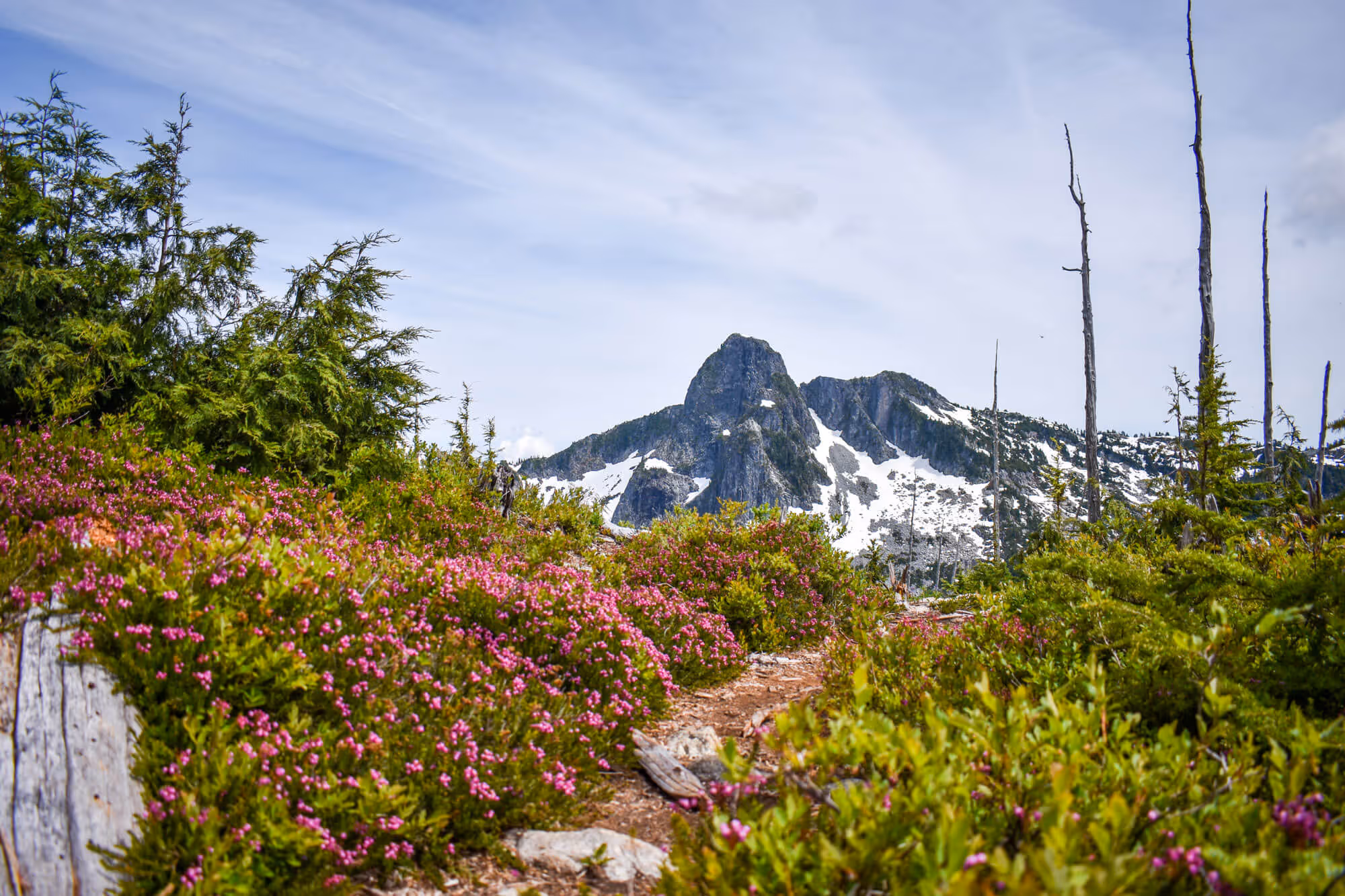
The hike was hard. We mean really hard. It is essentially doing the Grouse Grind twice - and then having to go back down. DO YOU KNOW HOW HARD THAT IS ON YOUR KNEES? The trail condition was good - we actually bumped into a group of Lion’s Bay residents who build/maintain all of the trails - nice people. The view was spectacular - like the Lions, it looks out towards Howe Sound to the North, but the view to the south is the Lions in all their glory. It took us about 7 hours to complete - which we consider a little slow. We should be able to shave an hour off that time.
Would we do it again? Yes? At the top, Chris said “I will never do Brunswick Mountain considering it looks uglier than Harvey and is higher in elevation”, however, he has since come around to the idea now that his legs don’t hurt anymore. If we had friends who wanted to do Harvey, we would probably do it again. The scotch at the top would also be a large incentive for him ;)