


For our journey through the north section of the West Coast Trail (Nitinat Narrows to Pachena Bay), we planned to cover the 32 kilometers of trail in 3 days. This means on average we would cover about 10 kilometers a day, but with about 34 pounds on each of our backs, we made the decision to take the first day slow & easy and camp at Tsusiat Falls.
Tsusiat Falls is only around 8km from our starting point (Nitinat) and a popular campground because of the beautiful beside waterfall. It is a major attraction in the north section of the WCT, so we decided it was worth spending a night by it.
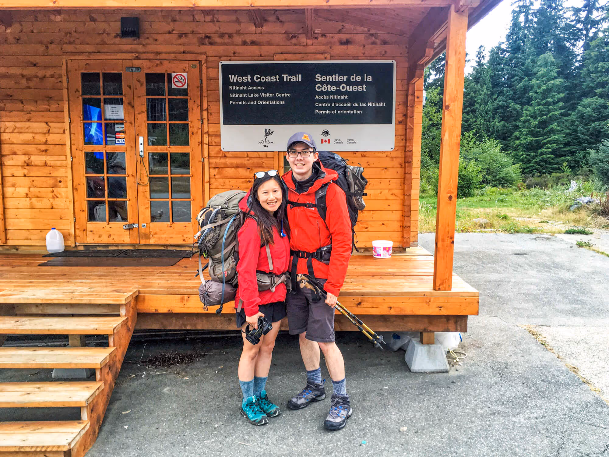
Nitinat Lake Motel & Nitinat Visitor Centre
Our day started around 7AM. We got out of bed, washed up and had some fruits and bagels for breakfast. We packed up our backpacks and headed off to scout the location of the orientation session.
It turned out the orientation session was hosted in the wooden building right beside the Nitinat Lake Motel and Visitor Centre/General Store. Knowing that we had some time to spare, we walked around and browsed the store.
The Visitor Centre offered hot food, hot drinks, miscellaneous camping supplies and water taxi tickets. We saw other hikers finishing up their breakfast as we bought coffee and our water taxi tickets.


8AM – Orientation Session
We headed over to the wooden building for our orientation session around 10 to 8. We bought our National Park passes and got our waterproof WCT map (free for hikers) here. The orientation session started on time and covered back country camping etiquette, tsunami shelter usage protocols, what to do when injured, food storage best practices, tide schedules, and other important information of the trail.
The session lasted about 45 minutes. It covered everything Chris and I had already expected. The only new information we got from the session was that there may be river crossings and that one should not carry a pack more than 20-30% of your body weight.
For some reason, we had not read about or expected river crossings to be required for this hike – we did not prepare for it. We soon learnt that river crossing are usually done instead of using cable cars because the trail to cable cars resulted in a longer trek. Many people chose to cross the river as a short cut when water level allow for crossing on foot. However, there are several small streams that you may have to cross over by foot.
Armed with tide table printout, waterproof WCT map, and our not-so-light packs, we were ready to be on our way!


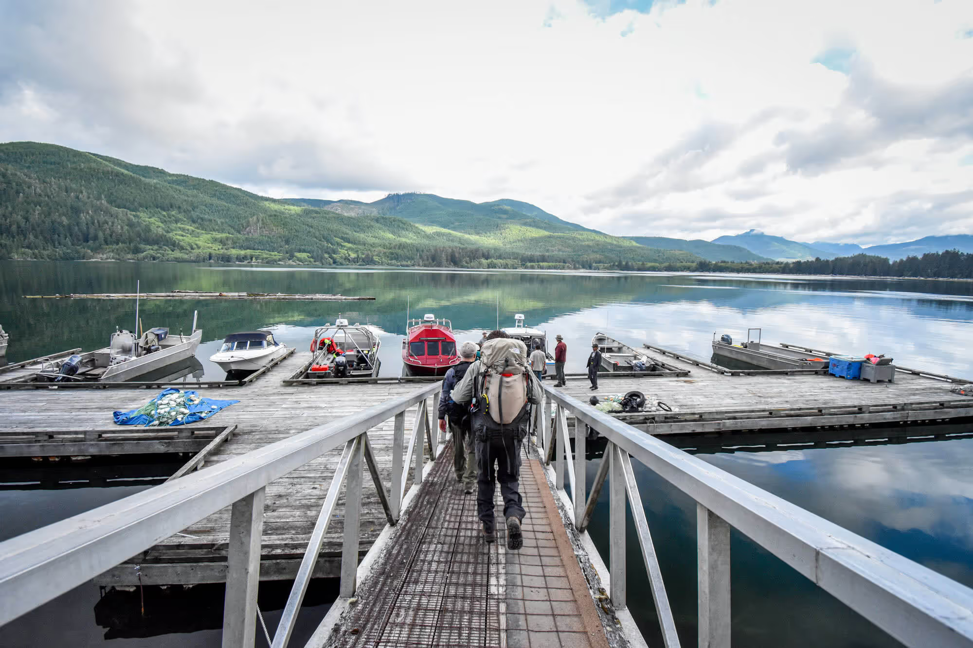
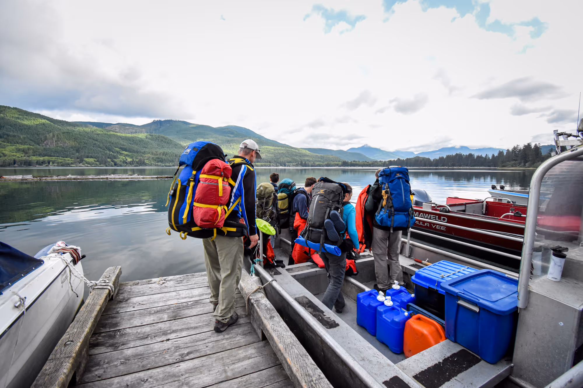
9AM – Water Taxi to Nitinat Narrows
After our orientation, we were led on a 5 minute walk to Nitinat Lake to board our ride to Nitinat Narrows. There were about 12 hikers in total. They divided us up and loaded everyone onto two motor boats.
The weather, as you can see in the pictures, was overcast. It also started to drizzle a little during our boat ride. Thankfully the water taxi provided insulated coveralls for everyone to wear for the 45 minute ride. The insulated coveralls kept us warm – we were a bit worried about the breeze.


10AM – Start of the WCT (Gaiters On!)
The water taxi took us to the south side of the Nitinat Narrows first. This is where the Crab Shack is located and where a group of hikers were already dining. Since Chris and I were headed North, we hoped onto another boat and crossed the Nitinat Narrows.
After getting dropped off at the north side of the Nitinat Narrows, we knew this was it – the start of the West Coast Trail! It was about 9:50AM.
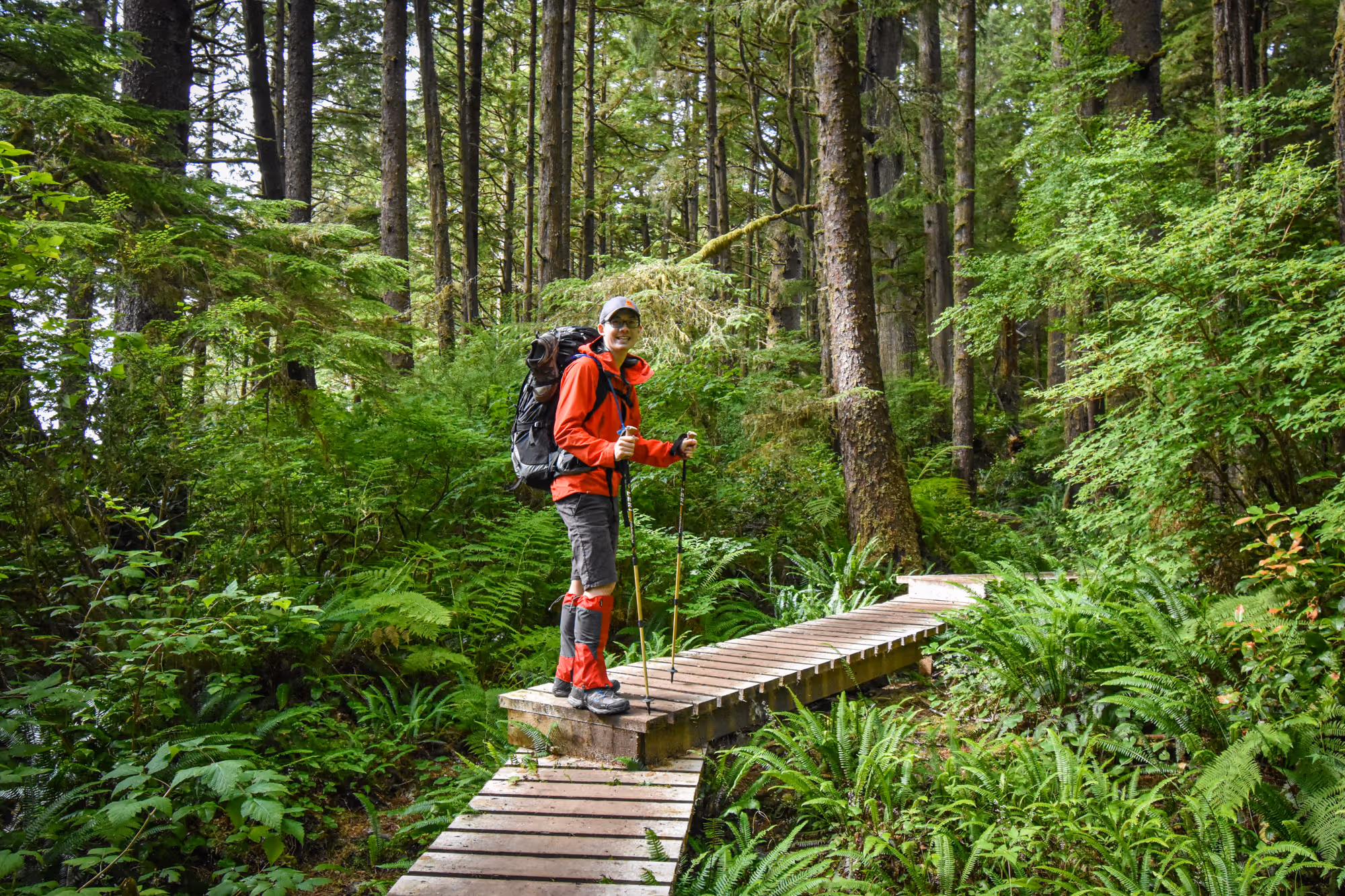
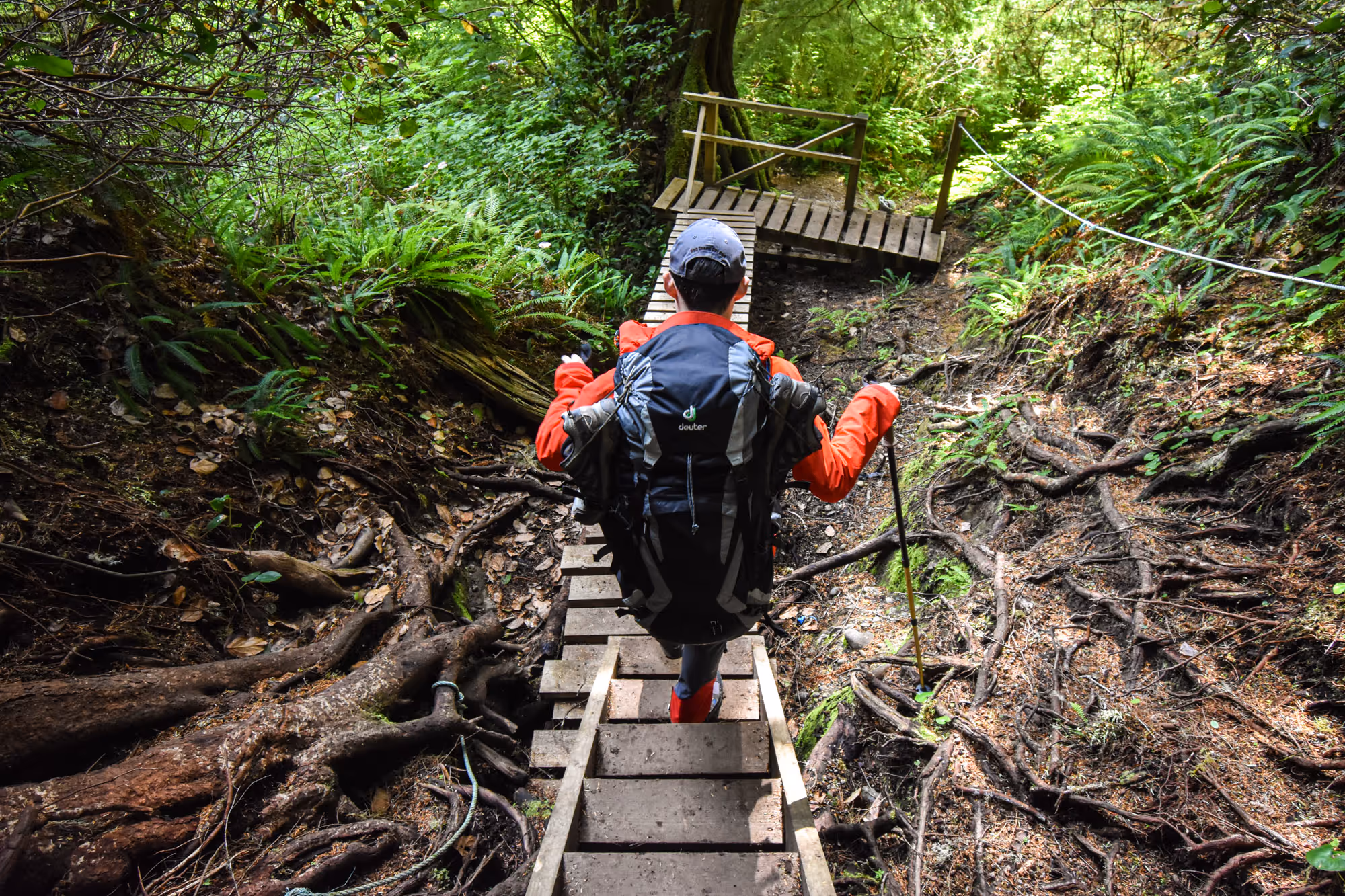
Although the weather seemed to have cleared up a bit since the morning, it was still pretty overcast. Chris and I decided to gear up and put on our brand new gaiters in preparation for some muddy trail. We got our gaiters from MEC just for this!


The first bit of the trail was in the luscious rain forest as seen in above photos. Wooden walk-ways are built over area that are prone to be muddy. This kept us clean.
After a kilometer in, we started to see a glimpse of the ocean on our left. It was gorgeous. Very different from what we’re used to when we hike up mountains. With the first beach access coming up ahead, we knew we wanted to get closer to the ocean so we chose it over the forested trail.


11AM First Beach Access
Each beach access is marked with boat floats hanging from trees. This made it easy to find access points. After spotting our first access, we decided to head down to the beach and get close to the water.
Being close to the water is a great feeling. The sound of the waves washing up on the sand and the breeze blowing through our hair felt amazing.
BUT, after a few minutes of trekking in the sand, it was evident that, as awesome as it is hiking along side the ocean, it was very tiring. Walking on sand is substantially more effort than a forest trail, especially with a full pack on, every step took effort.
By this time, the sun was out and the day was getting warm. We ventured around the beach and decided to take a snack break where we each had half a bagel while hiding in the shade of a beached tree stump.


Comfort Camping
After our break, we continued forward. The beach trail ended and joined the forested trail. This shortly led us to the Ditidaht First Nation’s Comfort Camping site.
For those interested in a night of glamping (glamorous camping), this is definitely a great option. Check out their booking site for details. There are packages to experience the WCT without having to trek the entire (or half) the trail.


12PM Second Beach Access & Whales!
After passing the comfort camping grounds, we continued on and took the next beach access at around marker 29km at about 12PM. The challenges of trekking along the beach had not deterred us yet!
We heard from other hikers that they have spotted whales in the water. So we couldn’t miss out on this. Beach trail it was!
Surely enough, we were able to spot some whales out in the water as well! It was pretty unreal to see them, they were quite a few of them just 100-200 meters out from the beach! The last time I saw a whale was when I specifically went whale watching in Iceland – which I paid lots of money for.
Chris heard them first – the sound of them blowing water. This got us both super excited even though the whales stayed mostly in the water, so we only saw a fin here and there. It was definitely a highlight of our WCT experience!


After 2 kilometers of trekking on the beach, we arrived at the famous Tsusiat Point! We found that it took us significantly longer trekking along the beach than on forested trail. We were averaging about 2 kilometers an hour where we would normally average about 3-4 kilometers an hour in the forested trail.

1PM Tsusiat Point
We arrived at Tsusiat Point around 1PM. After trekking through ~2 kilometers of rocky and sandy terrain in the scorching sun, we were pretty ready for a break. We joined a few other hikers and took a lunch break here.
The following pictures are of Chris exploring the area. Tsusiat Point is quite picturesque. It was definitely worth exploring and taking the beach route!


We took a long break at the Tsusiat Point – we knew we had an easy day and was able to take it slow. It was also very breezy and comfortable under the shade of the rock arch. We rested and enjoyed the ocean views with whales blowing water in the distance for an hour before we continued on.
Note on fresh water availability
We bumped into a couple of hikers who seemed very worn out and thirsty while we were eating lunch here. It seems that there aren’t many places to fill up your water between Cribs Creek and Tsusiat Falls. Fill up your water when you have a chance!!
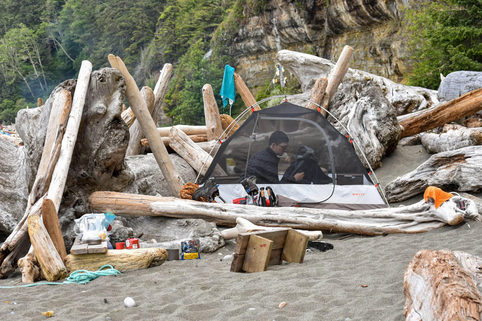
3PM Tsusiat Falls
Since Tsusiat Falls is situated on the beach, we continued our trek using the beach route and reached Tsuiat Falls by 3PM. Getting to our destination of the day at 3PM was early – this meant that we got prime real estate for our tent, but it also meant that we had a lot of time, but not much to do. (Sleeping on sand isn’t actually as comfortable as you would think – even with a sleeping pad. Tip: Level the sand under your tent with a log before setting up camp).


With the sun still scorching above us, we were desperate for shade. The amount of difference between sitting in the shade and in broad sun light was massive. We eventually found shelter in a little hut made by drift logs. With not very much to do, we took a nap.


Closer to 5pm was when the heat was more bearable. This was when we re-filled on water from the falls and started cooking our dinner.


Note on camping at Tsusiat Falls
Tsusiat Falls is a very popular location for camping overnight, but there is limit space in the food lockers. Either try to secure a spot in the food locker early in the day, or be prepared to hang your food from a tree.


Resources
- West Coast Trail Bus
- Parks Canada: West Coast Trail Info
- West Coast Trail Reservation (booking opens 8AM PST on April 30, 2021)