


Hey everyone, this is Chris here. While Nancy is editing some nice photos she took, I am here to tell you about our adventure to Elfin Lakes and Opal Cone!
Each time we do a challenging hike and finally get back to the car, I think to myself, “my body hurts so much, I don’t think I have ever done a hike that hard before”. I’m not sure if this just means we are continually doing harder hikes, or my body is very good at repressing memories.
Based on how I feel after doing hikes, you could assume that I am a masochist – Opal Cone was no exception to this sentiment. Seriously, I couldn’t ride my bike to work the day after. I could barely go down the stairs to the skytrain station.
Let me tell you a little more about why I was so wrecked. The hike to Elfin Lakes (11 km, one way) is a moderate and beautiful. We did the hike in early April with snowshoes and it was a great experience other than getting caught in a blizzard… again, sucker for pain. But, doing both Elfin Lakes and Opal Cone together (17.5 km, one way) is a different story.
Opal Cone is considered a difficult hike. The difficult rating is based on its long distance and the scramble at the end. This can put quite a toll on your knees and body if you aren’t prepared. We planned our hike as a 2D1N journey. On the first day, we hiked up to Elfin Lakes, set up camp, and then did Opal Cone. Then, on the second day we hiked down from the campsite to the car.
I honestly think if we were to hike Elfin Lakes and Opal Cone together again, it would either be a single-day hike (out and back) or a three-day overnight trip. This would minimize the total distance hiked with an overnight pack which would result to a happier Chris!
Directions to Elfin Lakes Trail Head
Getting to Elfin Lakes’ trail head is a bumpy ride. There is about 10 kilometres of unpaved logging road that is best tackled with a 4 wheel driven car. BUT, our Mazda 3 made up the road alright. Nancy only winced a couple times while we drove through unavoidable pot holes.
The parking lot at the top is sizable and can likely park up to 30 cars with no problems. When we got to the lot, it was about 8 am on a Sunday and the lot was 60% full. We suspect most of the cars were from overnight hikers from the day before.
The Hike to Elfin Lakes
The trail head is at the end of the parking lot beside the trail map/ info area. The hike is about 11 kilometres to the Elfin Lakes campground/shelter and should take you approximately 3 hours. The incline is pretty gentle and the trail is well maintained.
The first bit of the trail takes you along a forested old logging road. About 5 kilometers into the hike, you will find a shelter with a wood stove, picnic tables, grey water sink and toilet facility. We rested here for a snack break. This is known as the Red Heather Shelter.


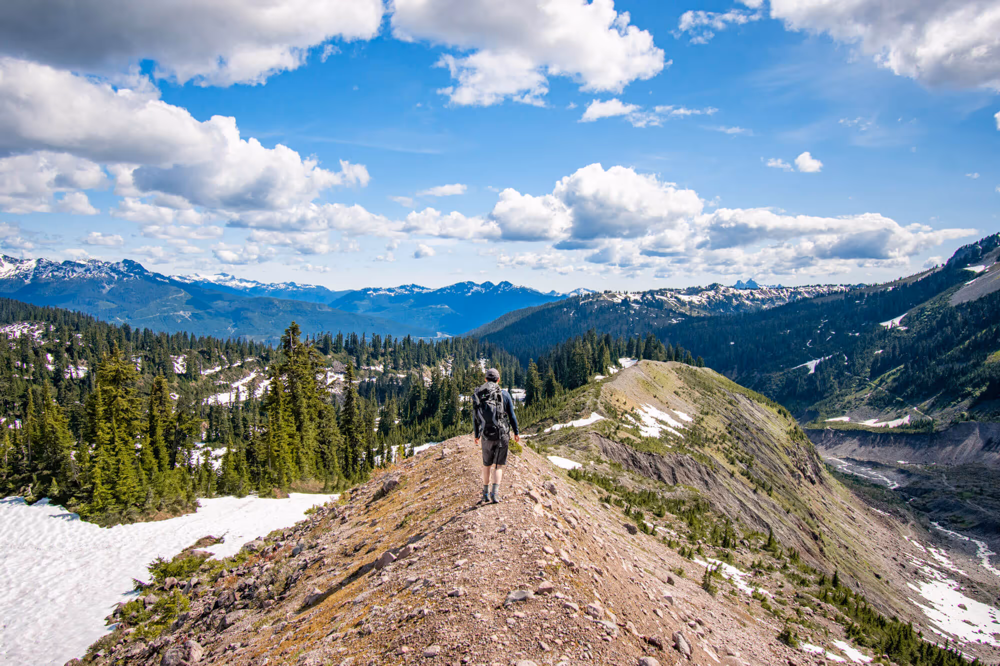
Along the second half of the hike, you will see great panoramic views of nearby alpine mountains with multiple water run offs to the side of the trail if you need to top up water. This hike is great for beginner hikers, backpackers and trail runners.


At the end of the trail, you will find yourself looking at quaint little huts by two beautiful (but small) bodies of water. The first hut is the park ranger station, the second is the Elfin Lakes shelter, and the third is a cabin you can eat in.


Elfin Lakes to Opal Cone Summit
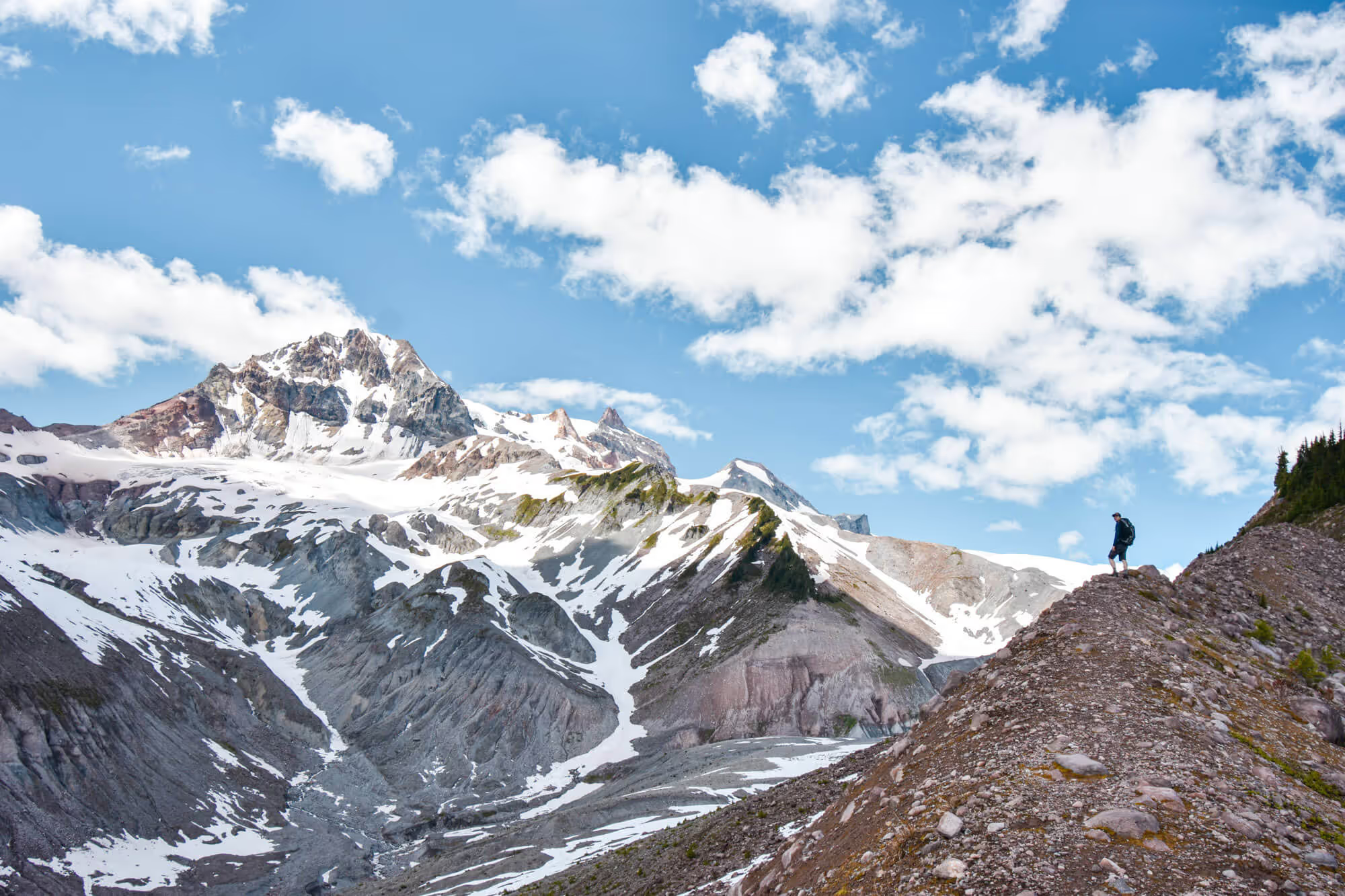
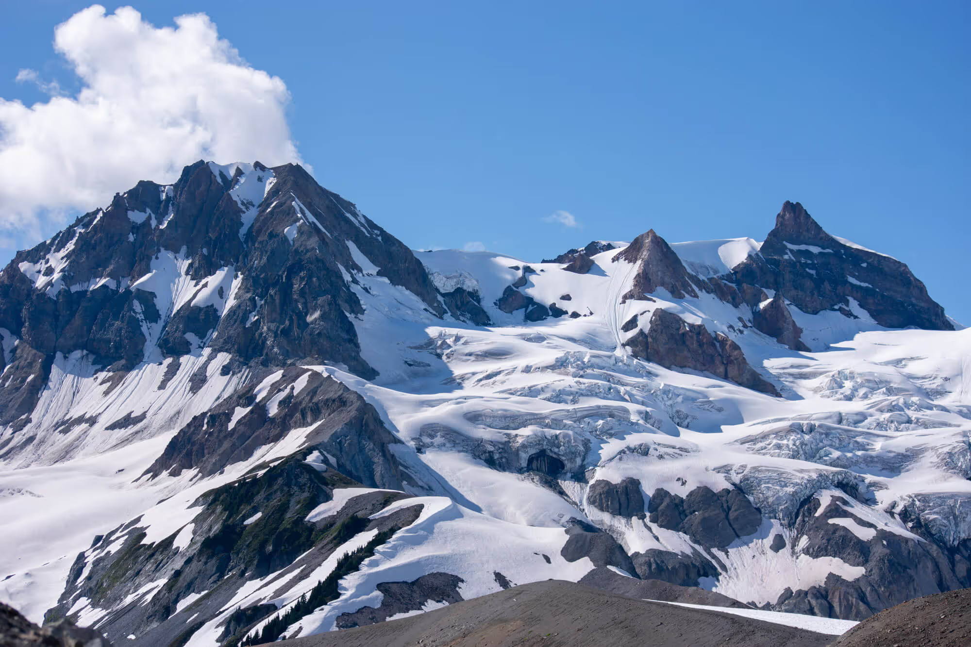
Opal Cone is an extinct volcano and exhibits a crater at the summit. It offers great view of Mt. Garibaldi, Mt. Atwell and nearby glaciers It has been proclaimed to be Nancy’s sister’s favorite hike – so it has been on our hiking list for a while now.
The trip from Elfin Lakes to Opal Cone is only around 6.5 kilometers each way. In my mind, 6.5 kilometers isn’t a long distance. However, after 11 kilometers up to the campsite with overnight packs, tacking on another 13 kilometer to and from Opal Cone leads to a rather long day. This solidly destroyed me. My knees were pretty sore from all the elevation changes. This is why I believe you should either do it as a one day hike with a lightweight bag, or a three day trip.
Trail Conditions and Views
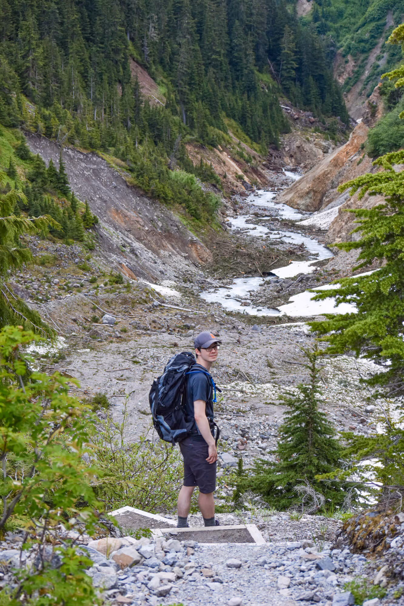
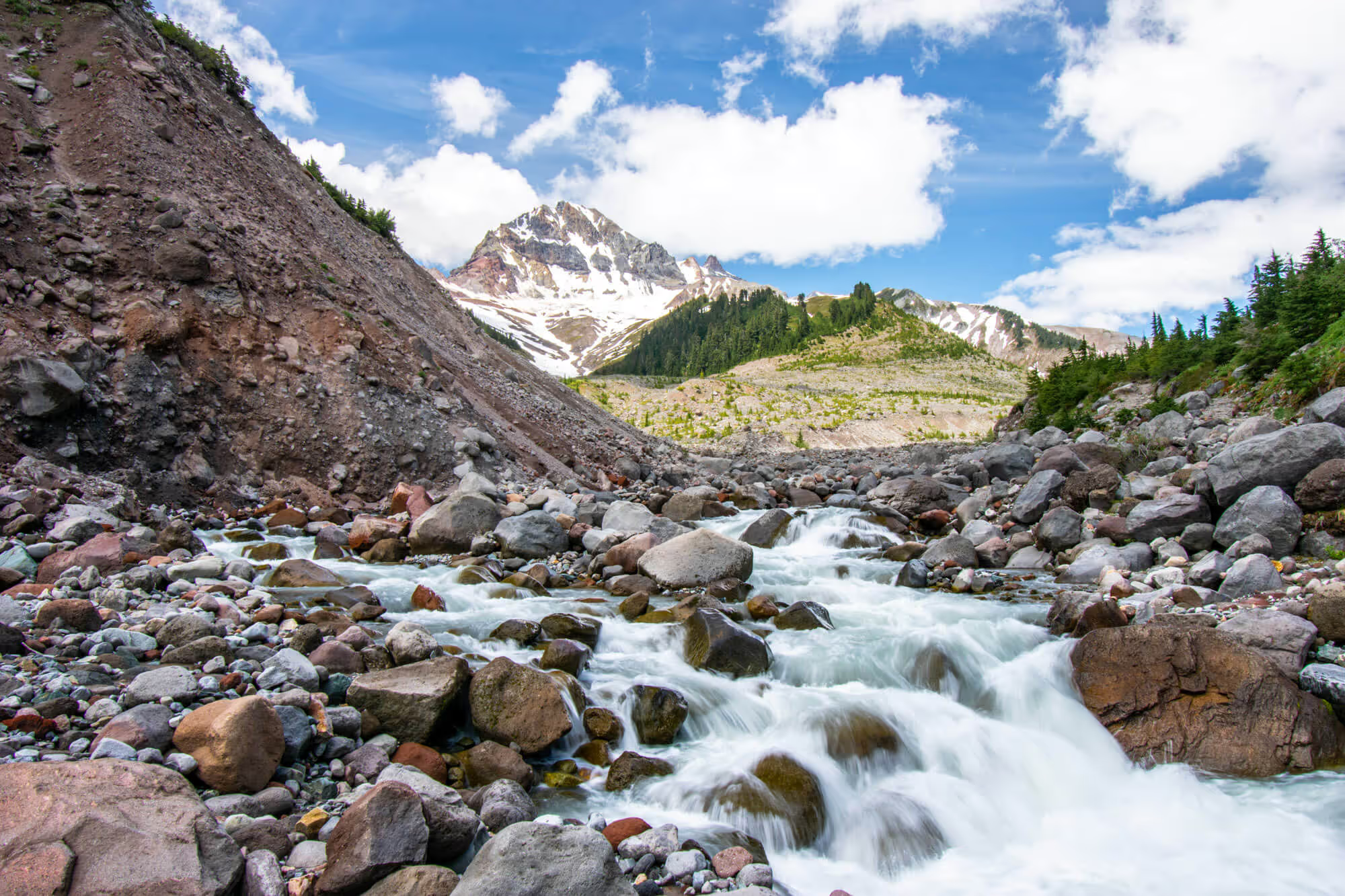
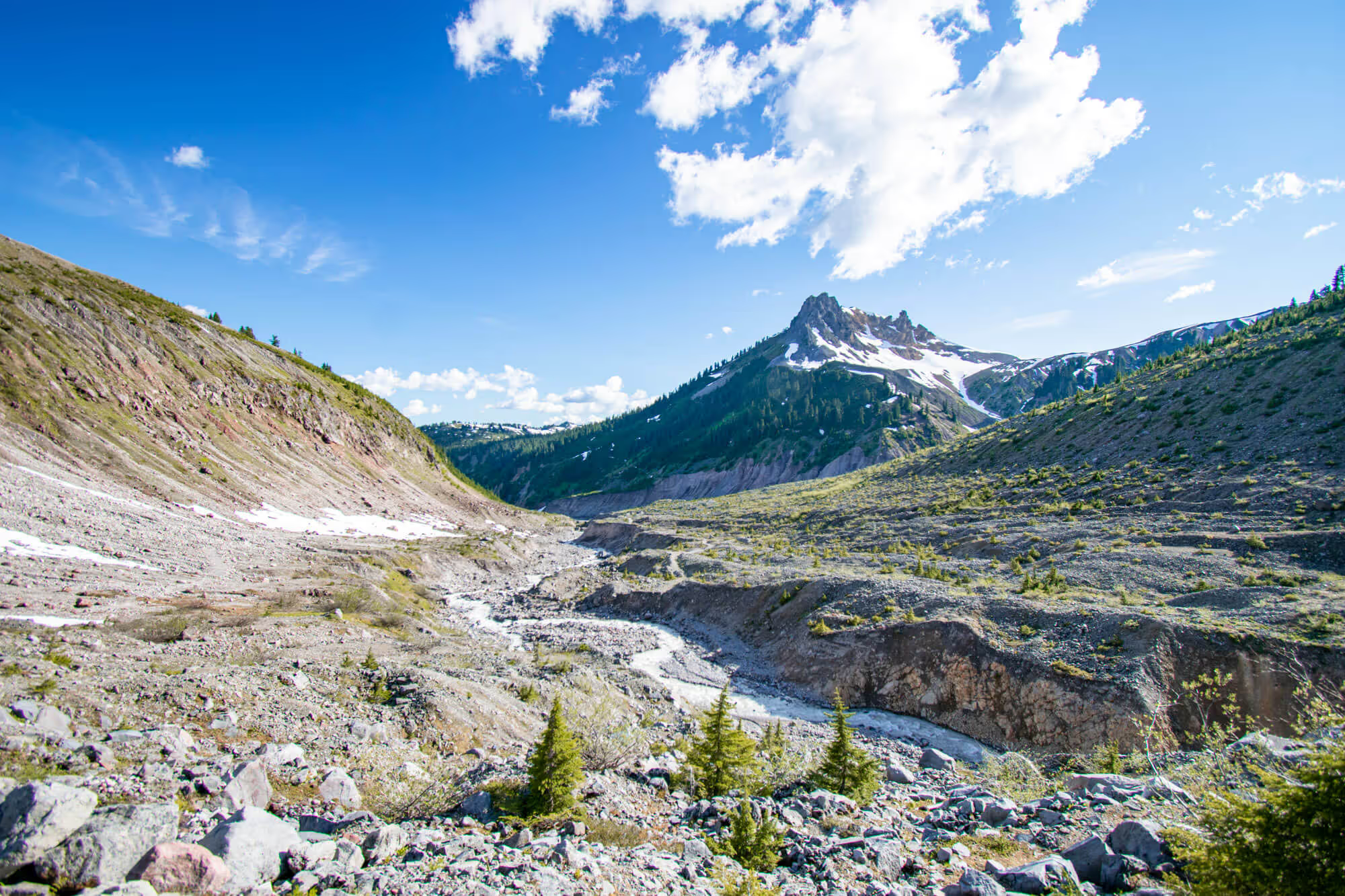
The first bit of trail to Opal Cone isn’t too scenic. There is a bit of up and down as you descend into a valley and cross a bridge. The trail is mostly an old logging road and then turns into switchbacks up a rocky face with a view of Atwell Peak and Diamond Glacier.


We found the trail to be very popular and saw many people heading back towards Elfin Lakes as we approached Opal Cone. Many of them assured us of the beautiful view that is at the summit of Opal Cone. Despite the popularity, we didn’t find the trail to be super well marked.
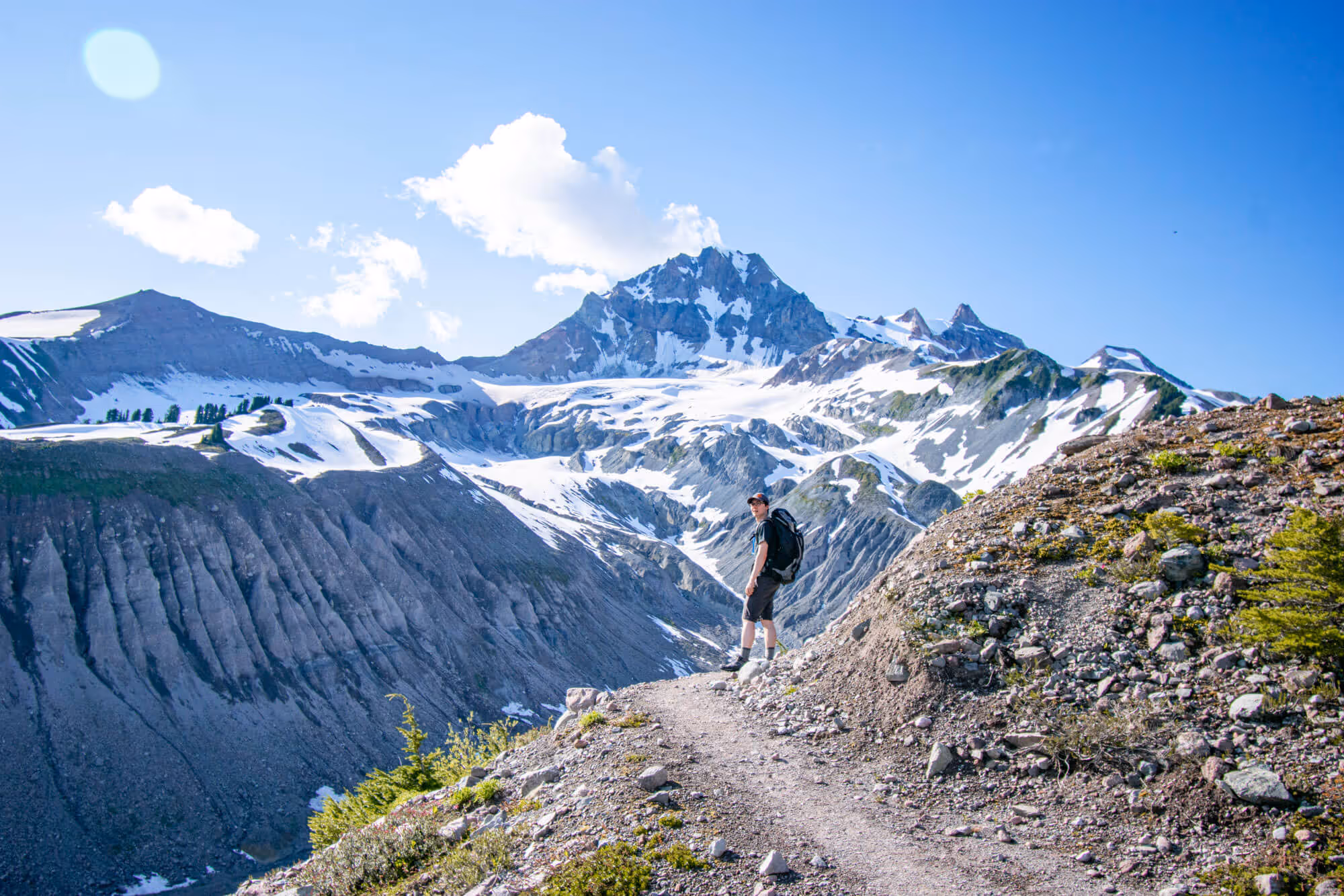
The Approach to Opal Cone Summit
The approach to Opal Cone summit is to the east of the cone. After the last switchback from the valley, you will have to continue on Elfin Lakes Trail towards Mamquam Lake a little further until you see the marker to Opal Cone on your left.


The last stretch of the hike to the top takes you along a ridge and leads you to a steep section where some scrambling is required. The scramble isn’t too bad, (it is about a Class 2 scramble) but with the number of people on the hike, you have to be cautious of people sending rocks down onto you.

Our round trip hike from Elfin Lakes to Opal Cone summit took us about 6 hours with breaks in between. This definitely was over our estimated time as we were quite exhausted.
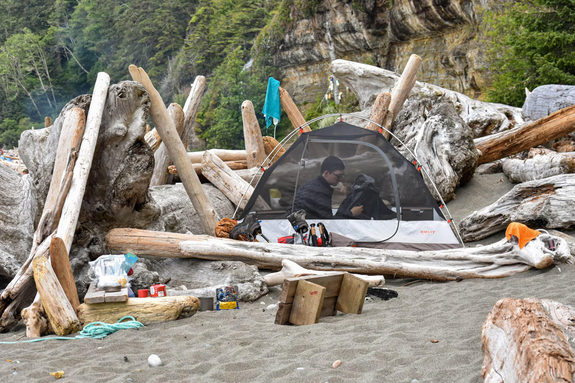
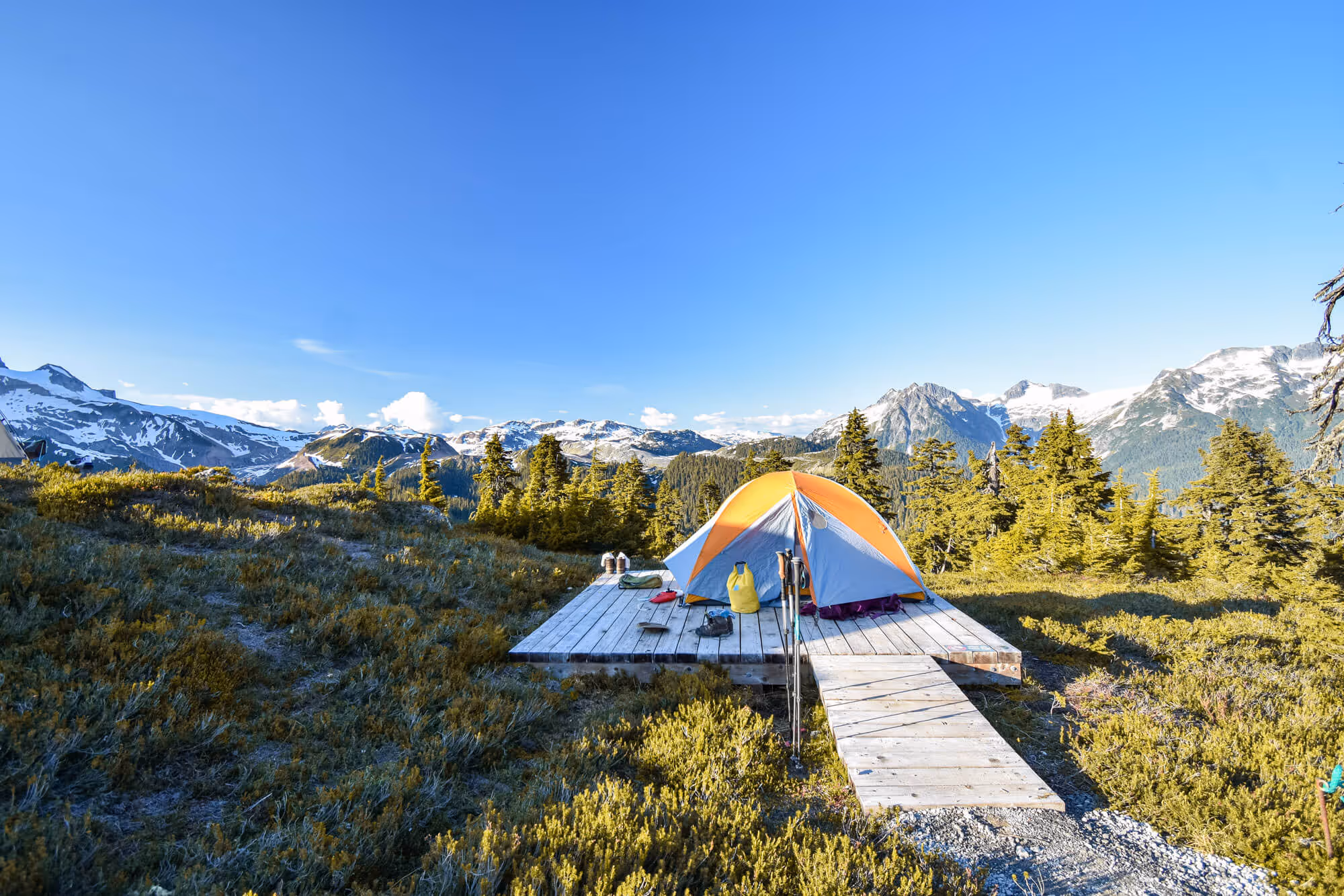
Overnight at Elfin Lakes
Elfin Lakes has great facilities for overnight stay. You have the option of camping on designated tent pads, or staying in the shelter on bunk beds. But, you will have to reserve in advance on Discover Camping.
If you don’t have a tent, or don’t want to carry as much gear on your back, the Elfin Lakes shelter is a very good option, especially if you are just getting into multi day trips. The shelter offers a gas stove, a pot for boiling drinking water, places to hang gear, bunk beds for sleeping (you still need a sleeping pad unless you are ok with sleeping on plywood). If you are more of a tent person, there are plenty of tent pads at the campsite.


Astrophotography at Elfin Lakes
Elfin Lakes is pretty far away from civilization, meaning that there isn’t very much light pollution at night. If you are used to living in a city, it might be a weird feeling for it to be pitch dark at night… but wait. It isn’t pitch dark. THERE ARE MILLIONS OF STARS.
It is amazing at night. The whole sky is filled with twinkling stars, and you can even see the milky way. Astrophotography isn’t something we are familiar with, but that didn’t stop us from trying to take some shots. Even if you aren’t interested in photography, you should still pop your head outside your tent and bask in the starlight.


Sunrise Views at Elfin Lakes
So… maybe you aren’t a night owl, or you were so tired from hiking all day that you didn’t get to see the stars at night. Don’t worry, there is another chance for an awesome view. If you wake up early, you can catch the sunrise, and the beautiful lighting that comes with it. A still body of water creates an amazing reflection


Conclusion
The hike was truly beautiful and we both enjoyed it. Would we do it again? Yes, but not as a two day trip. We would either do Opal Cone as a single day trip or as a three day hiking trip for the comforts of our knees.